What can flying drones over prescribed fires in Alabama teach us about wildfires in Colorado? Hopefully, a great deal.
A team of Colorado State University researchers is pioneering the use of drones, or unmanned aerial vehicles, and data modeling to create significant efficiency in evaluating post-fire impacts and give accurate predictions of post-fire tree health, enabling land managers’ decision making for post-fire recovery.
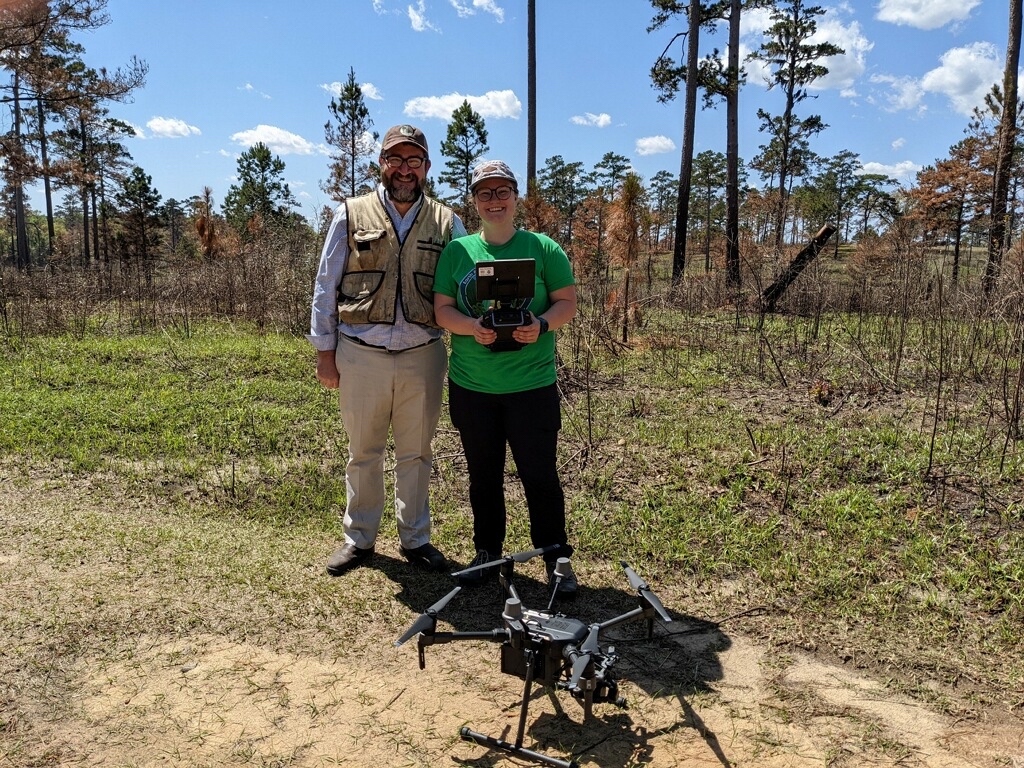
At the forefront of the effort is Forest and Rangeland Stewardship Ph.D. student Lauren Lad, whose work combines drones and modeling to predict fire disturbance effects on tree health and recovery. In March, Lad visited a prescribed burn in Escambia Experimental Forest in Alabama where she gathered data on prescribed fire effects in longleaf and shortleaf pine forests. She joined other researchers as part of a U.S. Department of Defense effort to improve fire management on military lands.
By assessing the crown scorch of trees using aerial footage collected via drone flights, Lad will estimate the mortality across burned areas and identify trees with less scorch that will serve as seed sources for regeneration or habitat for wildlife.
The time these techniques could save for fire managers and natural resources professionals could be significant, and Lad said she is hopeful for future applications of these tools.
“It takes a lot of time to assess scorch in the field, and it would be really helpful to say we can fly over the site pre-fire and post-fire with basically 10 hours of work, mostly at the computer and not in the field, to see what the scorch is and really save resources that way,” Lad said.
Field crews typically gather a sample dataset among impacted trees and then estimate scorch across larger areas with the sample as a basis. Using an unmanned aerial vehicle, or UAV, Lad and other researchers can collect imagery across 40 acres in about an hour and have a visual of every tree on the site.
How drones and data inform land management
Following a fire, it can take weeks to visually see the effect on trees. If land managers can input UAV data into a model just days after a fire to predict total scorch weeks later, they can move on to other sites.
Lad aims to find out how long after a fire people can gather data to get accurate predictions and best inform management action.
“How early in that post-fire period can we use our UAV imagery to predict what the total scorch will be? If there’s only a three percent difference in accuracy and prediction at three days versus 10 days, then it would save people a lot of money to just collect data three days after an event,” Lad said.
Having this level of detail can help differentiate crown scorch versus crown kill– trees that have died as a result of the event– which is critical for land managers to make decisions about post-fire recovery such as where to replant trees.
“If there are groups of remaining trees that serve as seed sources, we can do a spatial analysis and say, ‘Here are the distances between those refugees, so here are the locations that we need to fill in with planting to make sure the forest regenerates well.’”
Lad said she is excited about the potential for UAVs to gather data in the West, where lands can be inaccessible to field crews because of typography or limited/no road access.
“Drones have a lot of potential to cover that spatial gap,” she said. “Instead of having a crew hike a mile over tough terrain to a site, we can send a drone to the remote area and collect data much faster than we could bring a five-person crew out there.”
Lad also said she hopes her work will help cross bridges between different scientists to make informed decisions about forest health and recovery. Her research shows how individual trees are being impacted by fire, while remote sensing gathers data at a larger, less detailed scale.
“There is a really cool dichotomy of forest ecologists and remote-sensing scientists at CSU,” Lad said. “A lot of them are working together to bridge between individual trees to landscape scale, but I think we’re missing a lot of the fine-scale interactions that we can get with drones.”